
A couple of months ago I drove south through Capitol Reef into the Grand Staircase-Escalante National Monument, and I want to describe what it looks like, without sounding like a brochure.
The rock is red, then white, then gray, then pink, depending on where you are standing and how old the layer is. The formations step upward in bands — the Chocolate Cliffs at the base, the Vermilion above them, the White Cliffs above those — each band its own geological era, each color the accumulated record of a sea or a desert that existed here millions of years before anything that walks upright. The scale defeats the eye. You think you are looking at something near and find out it is an hour’s drive away. The silence in the middle of the day is the kind that makes you speak quietly, not because anyone is sleeping, but because the place seems to require it.
I wrote then that the landscape had handed me something and I was listening. What it handed me was a novel I had already half-written without knowing it.
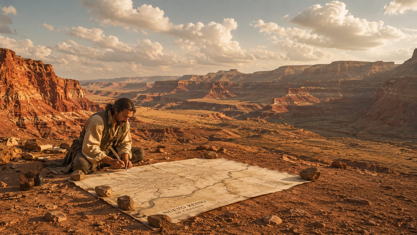
The Domínguez-Escalante expedition of 1776 walked through this landscape, or close to it. Two Franciscan friars, a cartographer, a small party of men, commissioned by the Spanish Crown to find an overland route from Santa Fe to Monterey Bay. They were not explorers in the romantic sense. They were agents of an empire that had controlled this territory for two and a half centuries, and they were looking for a way to connect two colonial outposts separated by an enormous piece of land that nobody in Madrid had ever seen.
That same year, on the Atlantic coast, the Continental Congress was signing the Declaration of Independence.
The two events had nothing to do with each other. The United States did not know this land existed. The land had not heard of the United States. This was New Spain — the Viceroyalty of New Spain, a dominion that stretched from what is now Canada down through Central America, and had been claimed by the Spanish Crown since the 1500s. It would remain Spanish until 1821, when Mexico gained independence and the territory became Mexican. It would remain Mexican until 1848, when the United States won the Mexican-American War and the Treaty of Guadalupe Hidalgo transferred it, along with California, Nevada, Arizona, Colorado, and New Mexico, for fifteen million dollars.
The people who lived on it — the Ute, the Navajo, the Paiute, the few Spanish settlers in the south — woke up one morning in American territory. They had not moved.
The Domínguez-Escalante expedition didn’t make it to California. Winter caught them in the Utah basin and they turned back. Their cartographer, Bernardo de Miera y Pacheco, mapped what they had actually seen: a large lake, carefully measured, its dimensions accurate. The lake was real.
Then a river appeared on the map, flowing west from the lake to the Pacific.
That river did not exist.
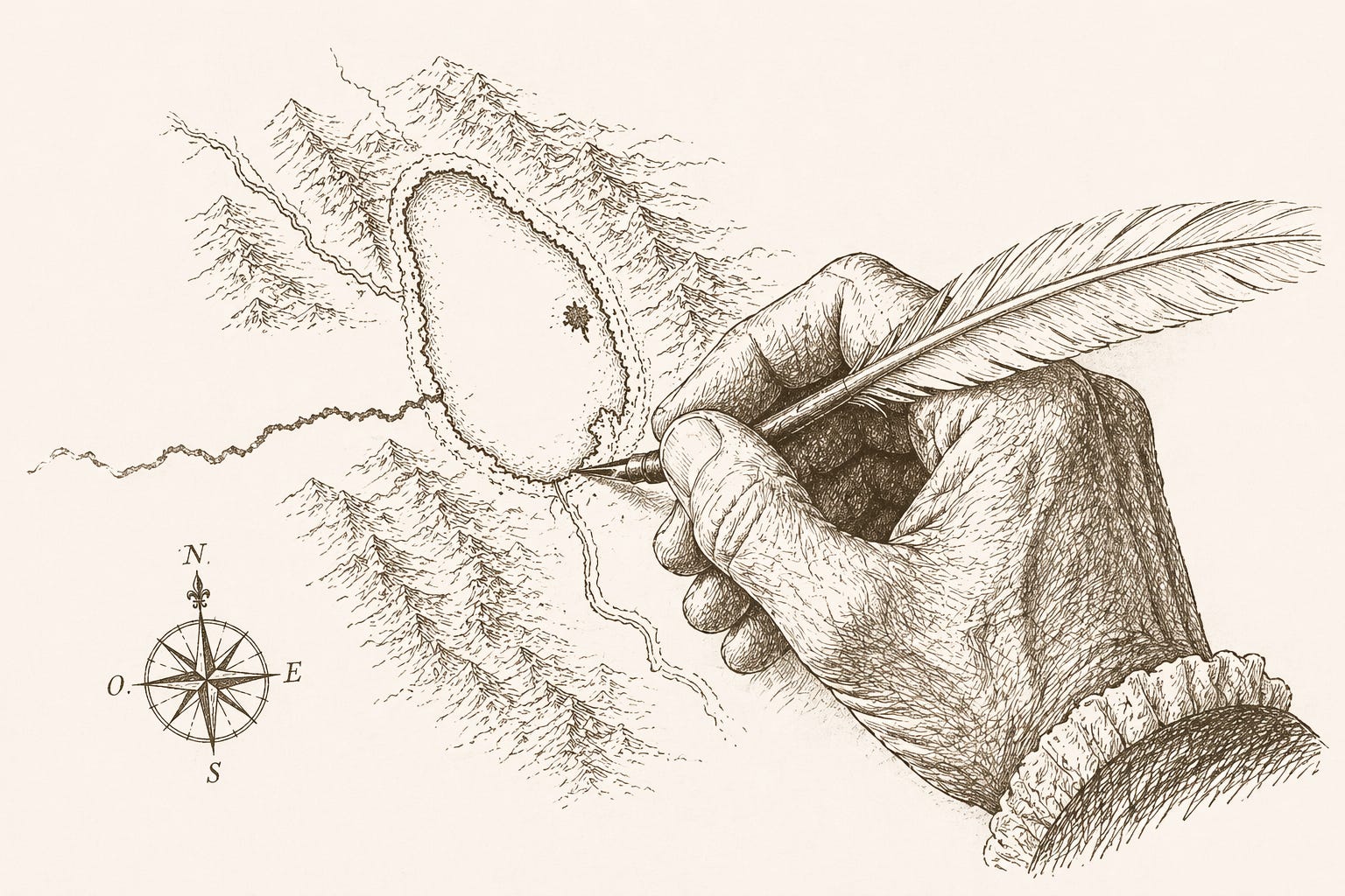
It wasn’t a lie, exactly. It was a wish written in ink. The expedition had failed. The map needed to mean something. So the map got a river, a route, a reason the journey had been worth making. Cartographers copied it from each other for the next sixty years. It appeared on American maps as late as the 1840s, when explorers finally followed its supposed course and found only desert.
What is a map? A record of what you found, or a record of what you needed to find?
That question is at the center of the novel. Getting there required getting past the problem that confronts every writer of historical fiction: there is almost no record.
We know the route the expedition took. We know when they set out and when they turned back. We know the names of the two friars and of Miera y Pacheco, who drew the river. Beyond that, the silences are long. What the men said to each other at night, what they thought as they crossed through Ute and Navajo territory without permission, what Escalante felt when he finally admitted California was not reachable — none of that is written down.
Historical fiction is not archaeology. You stand at the edge of a silence and decide what belongs inside it. You imagine characters who existed, write dialogues that might have happened, place invented thoughts inside real heads. You stay as close to the record as the record allows, and then you invent the rest honestly.
I wrote this novel first in Spanish. Spanish was the language this story happened in — fray, provincia, visita, doctrina — and those words have their own history inside them that English translates into procedure. The registers of the colonial church, the specific bureaucratic language of the Viceroyalty, all of it sits differently in the original. El lago que no estaba came out of that.
Then I rewrote it in English, which required different decisions at every paragraph. Not translation: rewriting. The same story told in a different architecture.
This happens with several of my novels. The two versions share a story and diverge in the telling.
There is another novel I thought about writing and had to abandon before I started. It was about the Lewis and Clark expedition, told from the point of view of the dog.
Lewis and Clark had a dog. A Newfoundland named Seaman, who made the entire journey, was nearly stolen by a hunting party who offered three beaver pelts for him, and survived. I thought the dog’s perspective might give the expedition a view from outside its own assumptions. The dog notices what the humans classify. The dog has no opinions about sovereignty.
It turns out someone had already written it. More than once. I’m glad I now chose Escalante, who is less crowded.
What draws me to this corner of history — and to The Book of Laments, about Bartolomé de las Casas and the Spanish colonial enterprise from the inside — is the same thing that pulled me toward the cartography in The Century of Silence and the imagined map in The Cartographer’s Daughter.
Maps are the tools empires use to make territory legible to themselves. They simplify what they cannot hold. They invent what they need. The lake in Utah was real. The river flowing west from it was Miera y Pacheco’s way of telling his employers the journey had not been wasted.
The desert in southern Utah does not know or care that it has been claimed by three different governments in the last two hundred and fifty years. The Chocolate Cliffs are still stepping up through deep time. The light at four in the afternoon is still doing what it was doing in 1776 when the friars crossed under it, and nobody wrote it down.
Some fictions are written in ink on parchment. Others are written in novels. The difference is mostly that novels admit what they are doing.
The Lake That Was Not There · English · Kindle · Paperback → https://mybook.to/LakeThatWasNot
El lago que no estaba · Español · Kindle · Paperback → https://mybook.to/ElLagoQueNoEstaba
I made a short film about this book — the landscape, the expedition, the invented river. Two minutes.
— Ricardo Gómez, Port Townsend